


Non-visible Architecture
by Richard Benishai | Articles
In the analysis of several locations, both in France and in Israel, the author found a strong similarity while performing energetic mapping of various religious buildings, such as churches and synagogues. Energetic mapping uncovers all geology disturbances underground, disturbances which were used to benefit the locations and greatly increase their energy level.
Our ancestors left nothing to hazard and took into account hidden underground singularities, prior to laying down the first stone. With time and with the advent of industrial progress, the builders no longer consider the effects of the cosmos and of the earth.
Eminent geobiologists, such as Georges Prat, have studied this subject. As a tribute to their work, let us present here a synthesis enriched by the experiments and the studies made by Richard Benishai in this matter. There are hundreds of examples which can be brought forward. A few are examined here to explain the non-visible architecture.
Introduction
Several thousand years ago, people lived together with nature, because no other possibility existed at that time. They possessed an inherent and natural sense for their environment. They used their hands to feel the energies coming from the ground, to locate suitable places to build their shelter. An example of this practice can be seen in the Golan Heights, near Gamla, where several hundred stone tables or dolmens were erected by this approach (5500 years ago). As time went on, they started to live in groups or in villages, their sixth sense diminishing. As such, they started to use instruments, such as divining or dowsing rods, pendulums and other detection means. However, the knowledge was still there, together for the need to live in a healthy place.
The year is 2005. Man is deeply immersed in a sea of technology, his senses reduced to a bare minimum. Very few today are aware that bad, as well as good energies originate under their feet. When building a house, a location is selected based on price, proximity to schools, shopping centers and accessibility. Energies? The great majority is not aware that vibrations coming from the earth can render one ill and worse. Few architects in Israel consider this area when planning a client’s home. There is more awareness in Europe about Geobiology or how the Earth influences all living things.
Networks and Other Singularities
Definitions
It is well known that our planet is covered by many electromagnetic networks: Romani, Peyre, Palms, Hartmann, Curry, Wissman, etc… Most are generated by metals, in the heart of the earth, in conjunction with the cosmic forces. Some are beneficial, such as gold, silver and copper, while some are neutral and others are detrimental to our health (Hartmann, Curry, Wissman, etc…).
Underground water streams criss-cross the interior of the upper crust, acting as the blood supply of the planet. The water molecules friction with the earth generates a number of physical phenomena: increase in gamma rays and infra-red radiation, electric and magnetic fields and radio frequencies. These effects cause some minor problems at first, followed eventually by serious illnesses. Our forefathers knew this and used stones, strategically placed to neutralize the negativity (Stonehenge in England and Carnac in France).
Faults are caused by rock plates separating, slipping or grinding one against the other. At times, differences in materials (rock and sand, or clay and sand, etc…) create a fault. Through faults noxious gases can seep to the surface (radon). The faults have negative effects on man/animals/plants in a manner similar to water.
Measurements
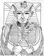
Egypt and the Pharaohs were well versed in the use of the pendulum. Records in the form of drawings made on papyrus, show that priests were using pendulums made of wood and of stone. The Pharaoh is shown in the most popular pictures as holding two sticks,
one of them being a pendulum, the other being a dowsing rod.
In doing measurements, the author has used modern versions of ancient tools : dowsing rods, Y-rods and a pendulum. See Figure 1. Energy values were measured in Bovis units (Bovis was a French engineer, working with Simonton, a physician), using a graph shown in Figure 2.
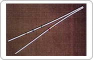 Y-rods Y-rods |
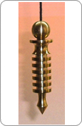 Pendulum Pendulum |
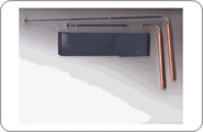
Figure 2: Graph Used for Energy Levels (Bovis)
Bovis had established that all living matter had a certain vitality that can be measured in Angstroms. This is also true for locations on the planet. It had been established at 6500 Bovis units (equivalent to Angstroms), then. This level went up a few years back to 10,000 and today it has leveled at 12,000. A place which measures at 12.000 Bovis units, neither takes or gives energy: it is neutral.
The graph shown in Figure 2 is used with a pendulum, to measure energetic levels, in Bovis units. Singularities, such as networks or water or faults are detected by either the Y -rods or the dowsing rods. See our page Products ). The pendulum can be further used to check the depth or the amount of water of an underground stream.
Ancient Building Layouts
Parameters used
One or more of the following physical, mathematical and visible guidelines have been used in laying out ancient sites. These guidelines are all or partially known by builders and architects today, as they have been used for hundreds of years. These are referred to as Visible Elements.
Other elements cannot be seen, calculated or even felt by most, without proper training. These are part of the non-visible architecture.
Visible Elements in an ancient building
- Direction of sun rise and sun set, as used in cathedrals and churches; see Figure 3.
- Facing the direction of a holy site, such as in the Jewish or Muslim religions
- Based on geometric representation of the skies, earth and underground (layout in churches); see Figure 4.
- Dimensioned using the royal cubit and the Golden number, such as done for the layout of antique Jerusalem (according to the work of John Mitchell)
- Used the pyramid angle (51 51′) for fa?ade layout; see Figure 5.
- Dimensioned using musical notes, especially for elevations, as shown in Figure 6 for Chartres.
- and others …
Figure 3: Establishing the Direction of the Sun

Figure 4: Geometric Representation
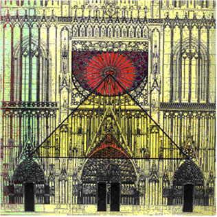
Figure 5: Pyramid of Kheops Angle in Cathedral of Strasbourg
Figure 6: Musical Notes with Elevation
Non-visible elements
In the following paragraphs, references and descriptions are provided on the use of non-visible architecture, to introduce the subject. The list below includes considerations taken by the ancient builders which are not so obvious and known to most:
- Use of underground streams: water running in complex networks, at a depth of 3-4 meters under the surface and reaching as far as 300 meters.
- Use of Hartmann lines: electromagnetic global network, running North-South/East-West, spaced at about 2-3 meters.
- Use of Curry network: the Curry network is 45 degrees shifted in relation to the Hartmann network; spacing between lines is from 4 to 8 meters.
- Use of faults (cracks): faults are discontinuities in the sub-terrain, such as split rock plates, rock and sand, clay and rock, etc…
- Use of sacred energy flow: permanent lines connect certain locations on this planet. See Figure 7. These lines were used as carriers of energy.
These singularities are defined hereafter.
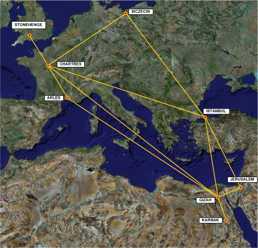
Figure 7: High-energy Flux Lines
Networks and Other Singularities
In the ancient days
It probably started with the positioning of dolmens and menhirs as far back as 6000 years ago. Dolmens were used as temporary burial places, whereas menhirs were located by our ancestors to neutralize negatively- charged locations. Examples of such dolmen and menhir, are given in Figure 8 and Figure 9.
We performed an analysis of the dolmens in Gamla. The energetic mapping of the dolmens is shown in Figure 10.
These stone tables were located so that they would fall over underground water streams and/or crossings. Usually there would be a Hartmann and/or a Curry crossing at the same location. Hartmann and Curry lines form part of electromagnetic global networks, running North-South/East-West for Hartmann. The Curry network is 45 degrees shifted in relation to the Hartmann network. This arrangement creates a very high energy location, the energy being distributed to those living around.
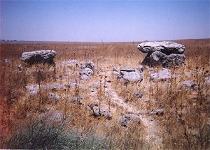 Figure 8: Two Dolmens in Gamla (Israel) |
 Figure 9: Menhir in Gauchmatt (France) |
Figure 10: Energetic Layout of Dolmen
Later in time
There is an ancient synagogue where Jesus prayed in Caupernaum (Kfar Nachum), near the sea of Tiberia,. This white stone building, dated at 351 AD, was erected on a previous construction, made out of black stone (see Figure 11).
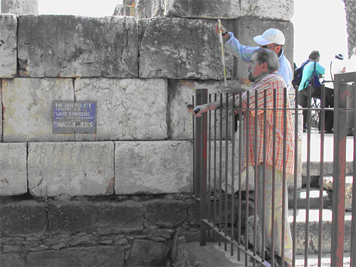
Figure 11: New Synagogue over Ancient Building
About the energetic layout of this synagogue, shown in Figure 12:
On a general approach, one can see that the columns are spaced and positioned over Hartmann lines. The Hartmann electromagnetic network is composed of lines running North/South (about every 2 meters) and East/West (about every 2.5 meters). In addition, the Curry network lines, which run at a 45 degree angle to the Hartmann network, have wider spacing, are also exploited in the layout scheme.
In the very center of the building, there is an underground river (at a depth of 164 m) and a fault (at a depth of 354 m).
As one progresses to the rear of the synagogue, the energy increases to very high levels.
Figure 12: Energetic Layout of Kfar Nachum Synagogue
A more recent church
In this next example, the builders made use of two powerful numbers: the Golden number (1.618) and 72. The Convent of Reinacker, near Strasbourg, France is almost seven centuries old. It is the residence of a group of Franciscan Sisters, who work and pray there (see Figure 13). According to our findings, the chapel was built using the same principles seen on ancient chapels and antique churches: positioning of the axis to run West- East; locating the main axis over an underground stream; positioning of the supporting columns at Hartman and Curry crossings; and more.
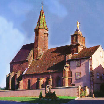
Figure 13: Convent of Reinacker
 |
The first detail to strike someone was the dimensions of the nave (14.90 x 9.00). Interestingly, 9.00 x φ = 14.56, where φ is the Golden Number, 1.618. This is not a coincidence as builders in those days sized rooms according to the Golden Number.Another dimension of interest is the angle formed by the roof of the nave. As measured, this is 72 degrees. This number was selected for its strength (72 names of God in Hebrew, 72 degrees in between each point in a pentagram, 72 chakras in the body, 72 days of mourning for Pharao, etc…).
Looking into the layout of the chapel Figure 14, there are some points worthy of noting here:
|
Figure 14: Energy Mapping of Reinacker Convent
Faults and Hi-energy Lines
We have seen already some usage of faults in locating sacred places of worship, such as in Kfar Nachum, above. The very famous and world-renown place, the Cathedral of Notre Dame of Paris made use of such faults, in its floor layout.
An Interesting Find
If one was to look closely at the alignment of the columns (and we almost missed it), one can see that the two sets of columns in the nave (main hall) are not aligned. See Figure 15 to note the distortion. One can also see in this figure that the walls are not straight.
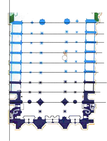
Figure 15: Distortion in alignment
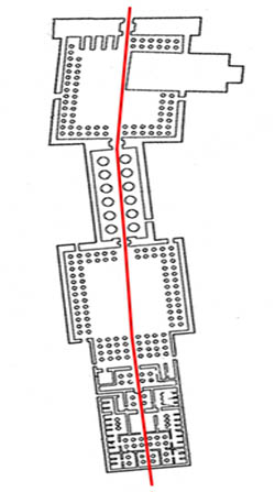 Figure 16: Temple of Luxor, Egypt |
The reason for this dis-alignment can be taken from the example of the Temple of Luxor, in Egypt (Figure 16). There, the builders took in consideration a fault, running underground (brown line in the figure) and a hi-energy line (in gold, in the figure) running next to the fault. The entire temple was designed and built around this fault and hi-energy line. Thus, the exaggerated angle we see in Luxor’s layout. Can it be that the fault under Notre Dame de Paris was also the reason that the builders used to layout the building with the slight angle seen in Figure 15 ? We believe it to be so. |
| Let’s look at Figure 17. The slight angle taken by the nave (front) in Notre Dame, in relationship to the choir (rear), follows an underground fault, 25 cm wide and about 75 m deep.
There is also a theory that the different angle is due to the axis of the nave being 26 degrees, indicating the sun rise at certain dates of the year and symbolizing Purification and Transfiguration. The axis for the choir is 23.5 degrees, the precession angle for the rotation of the Earth. These are facts. Without a doubt, our ancestors left nothing to chance. Every single parameter was based on some sound reasoning, dealing with the physical or spiritual worlds. |
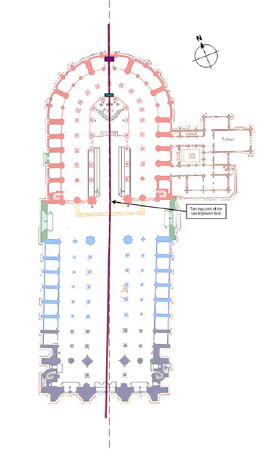 Figure 17: Slight angle in the axis |
Routing the Energy Underground
| As for many cathedrals, Notre Dame de Paris has a network of underground streams that gather energy from the front and directs to the back. Figure 18 reflects this underground network, with the direction of flow and the depth indicated at various points. At the start, the depth at the narthex is only 14 meters, whereas, at the center of the apse, the depth reaches 45 meters. At each point, the depth increases, so as to get the proper flow. The network may be water streams or river-bed stones laid out to form the streams. The energy received from the Cosmos, is gathered by the form of the ceiling at each aisle. The ceilings in the form of upside down cups, gather energy which is directed down the columns, at each of their corners, to the ground and to the underground water. See Figure 19. |
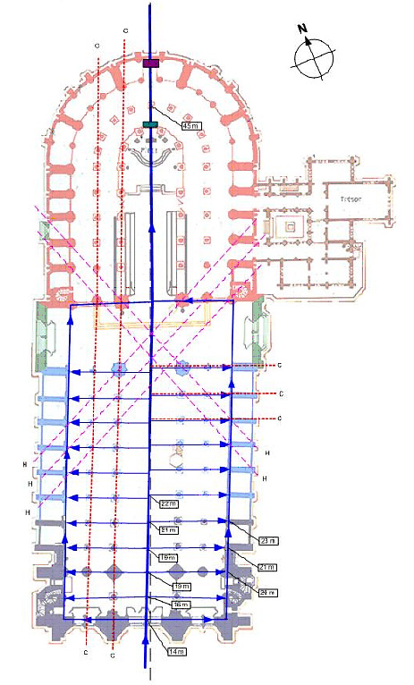 Figure 18: Underground network at Notre Dame of Paris |
In conclusion
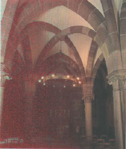
Figure 19: Ceiling and Columns
Buildings all over the world offer all evidence necessary to justify the non-visible architecture. In the examples given above, there are several commonalities, even though the construction was accomplished at different periods in time and in different countries. It seems that previous generations “knew” where to locate religious buildings, as well as dwellings. Unfortunately, with the advent of technology and modern times, man has swept away this precious knowledge; some of us even go as far as accusing anyone dealing with this subject as not balanced, as there is a certain fear or apprehension when dealing with the unknown and the unseen. Thus, today’s buildings are erected without energetic consideration for the land they will stand on, or for what lays below, and this mostly due to the lack of knowledge about the subject discussed in this paper.